IP Survey 2017
Below is a selection of the images from the IP Geophysical Survey completed in 2017:

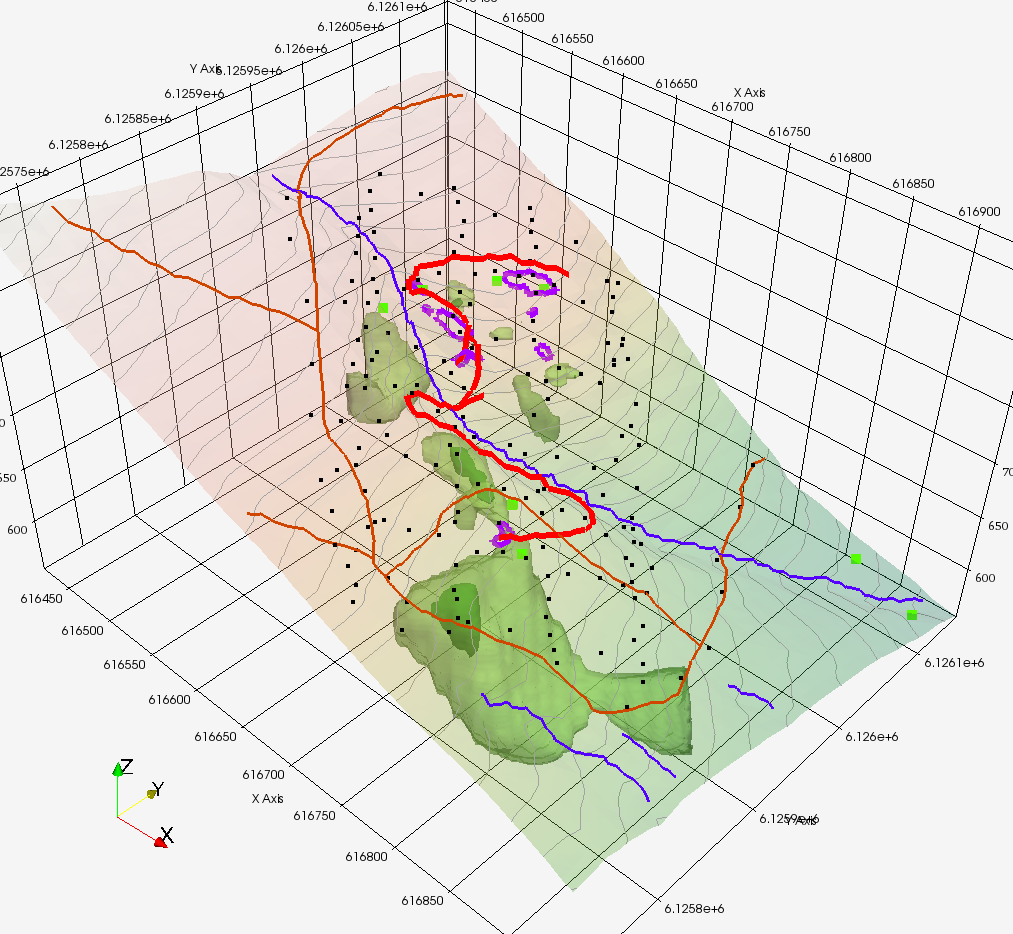
Plan view of 3DIP results at Max Target, purple outlines are channel sample locations. The blue represents resistivity, and the green is chargeability.
Side view (looking roughly east) – grey is topographic surface, so looking “down the hill” – blue line from lower-left to upper-right is the creek.
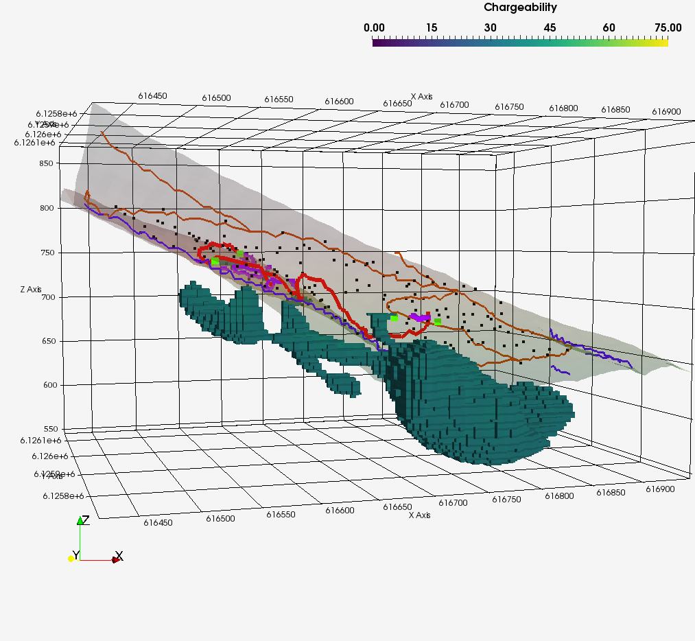
Side view looking NW, showing only chargeability. To the left corresponds with Jaxon channel samples at the 742 level, large body to the right is downhill from most sample locations.
Elevated view, looking down and from the north, only showing chargeability, in a lighter green. Again, blue line is stream, purple outlines are channel sample locations. Topographic surface shaded from pale pink to green.
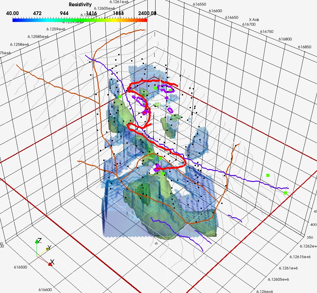
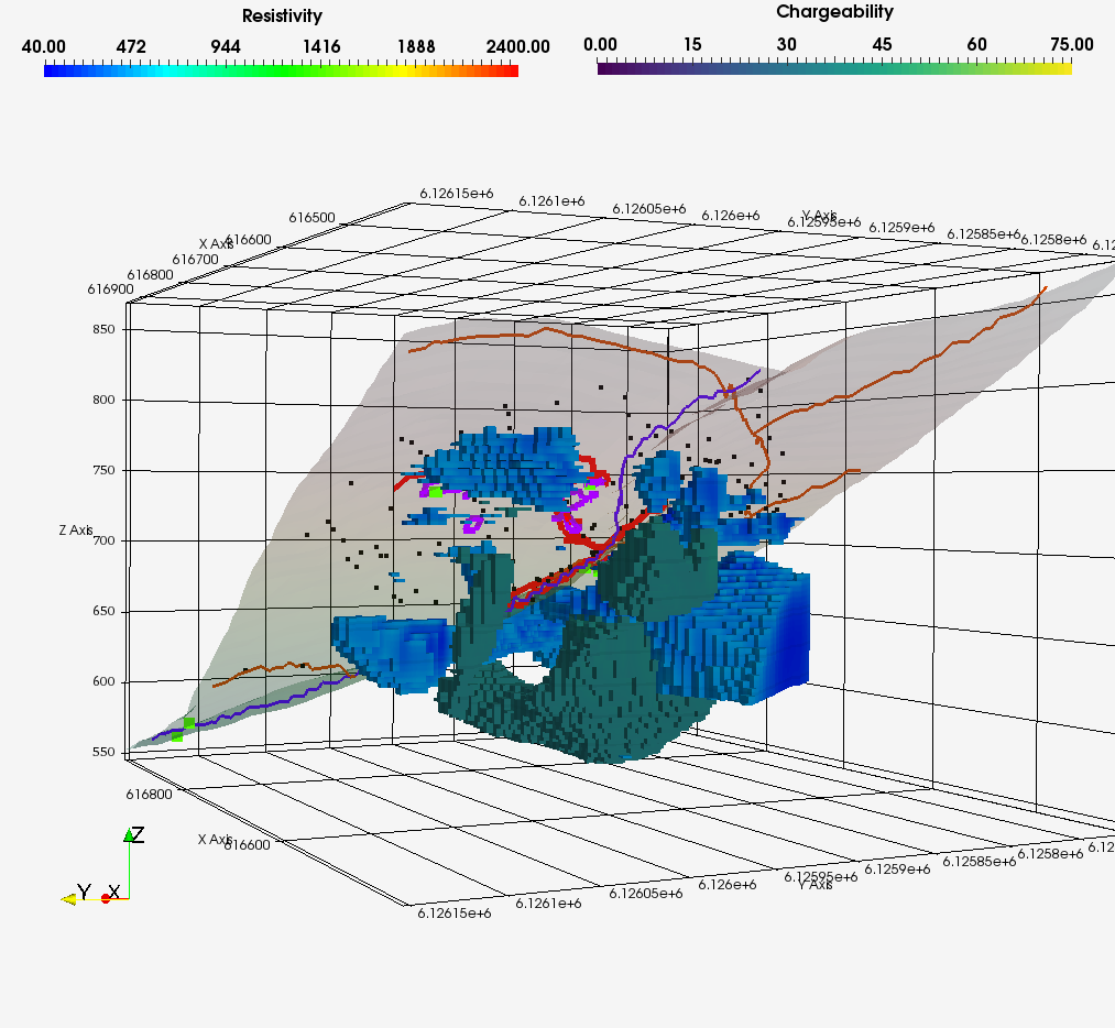
Also elevated from the north, showing resistivity in blue, along with green chargeability body. Topographic surface shading removed for clarity.
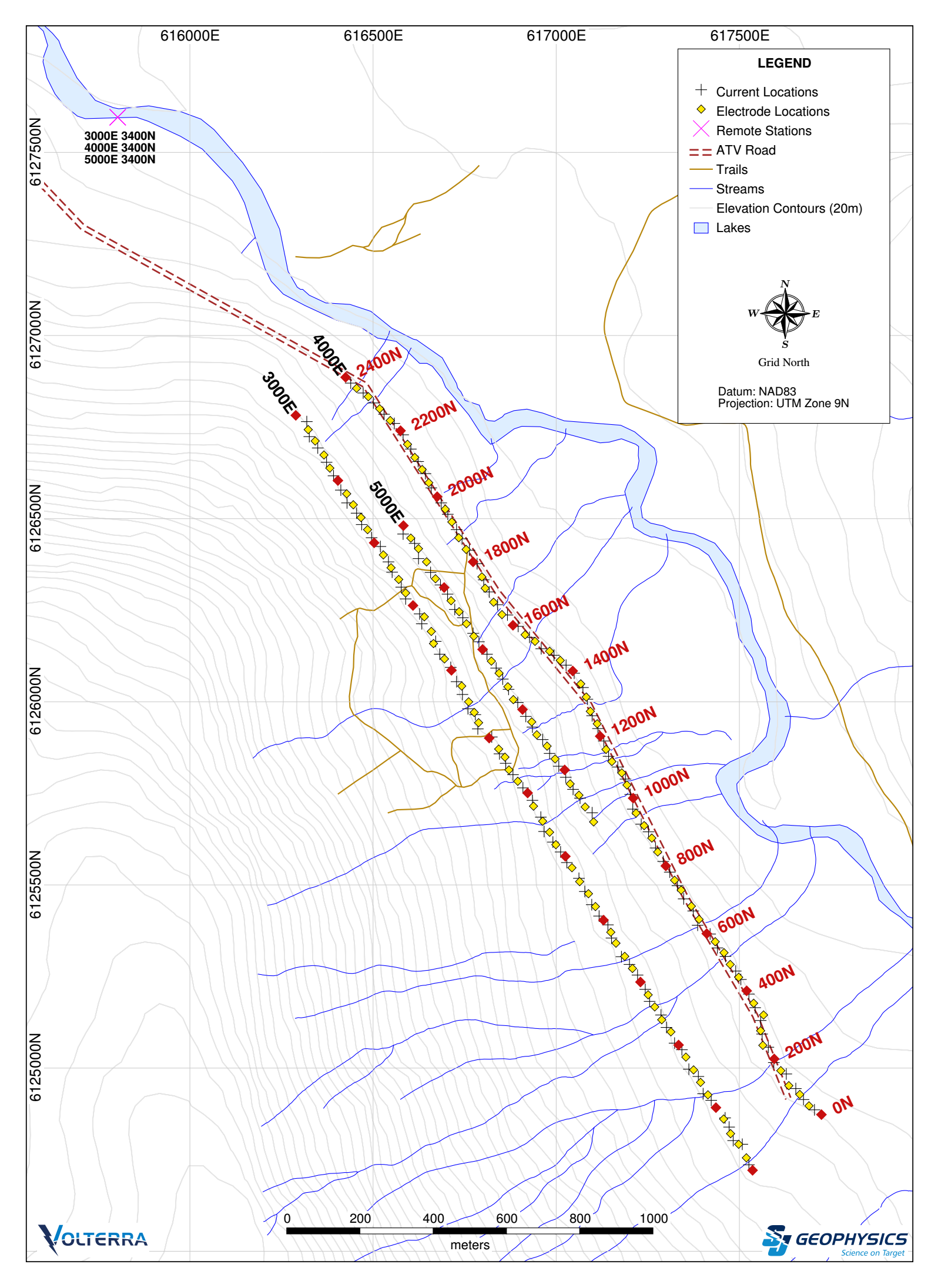
Plan view of Jaxon’s 2DIP survey at Max Target, Hazleton.
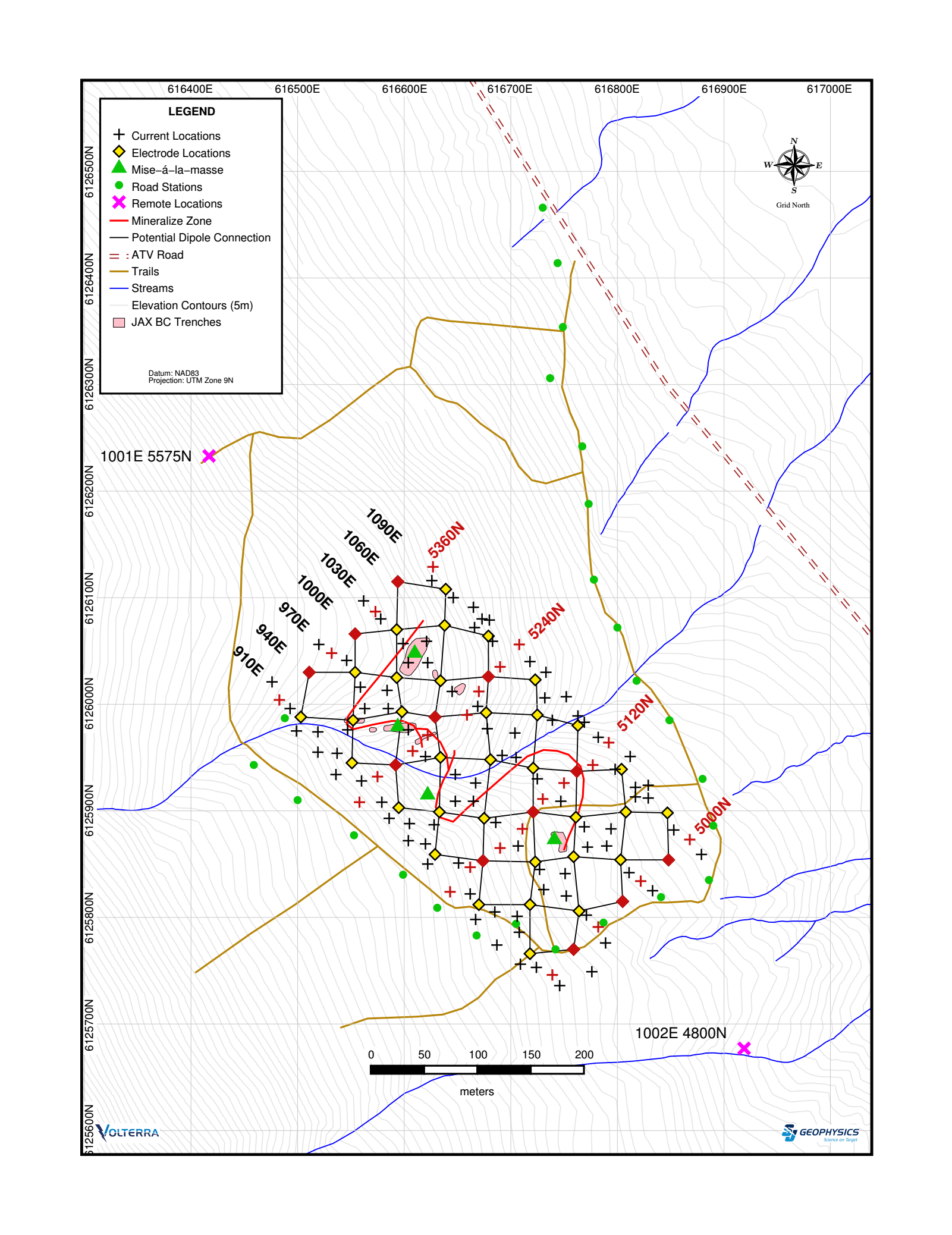
Plan view of Jaxon’s 3DIP survey at Max Target, Hazelton.